Safe Nuwara Eliya
Disaster Management
Preparedness, response and recovery efforts for natural disasters across the Nuwara Eliya District.
Cartographic GIS Intelligence
Official Disaster & Hazard Maps
Official spatial impact analyses, flood inundation extents, and landslide susceptibility zonation maps prepared by the Disaster Management Centre & NBRO.
Click any map to open full interactive zoom & pan viewer
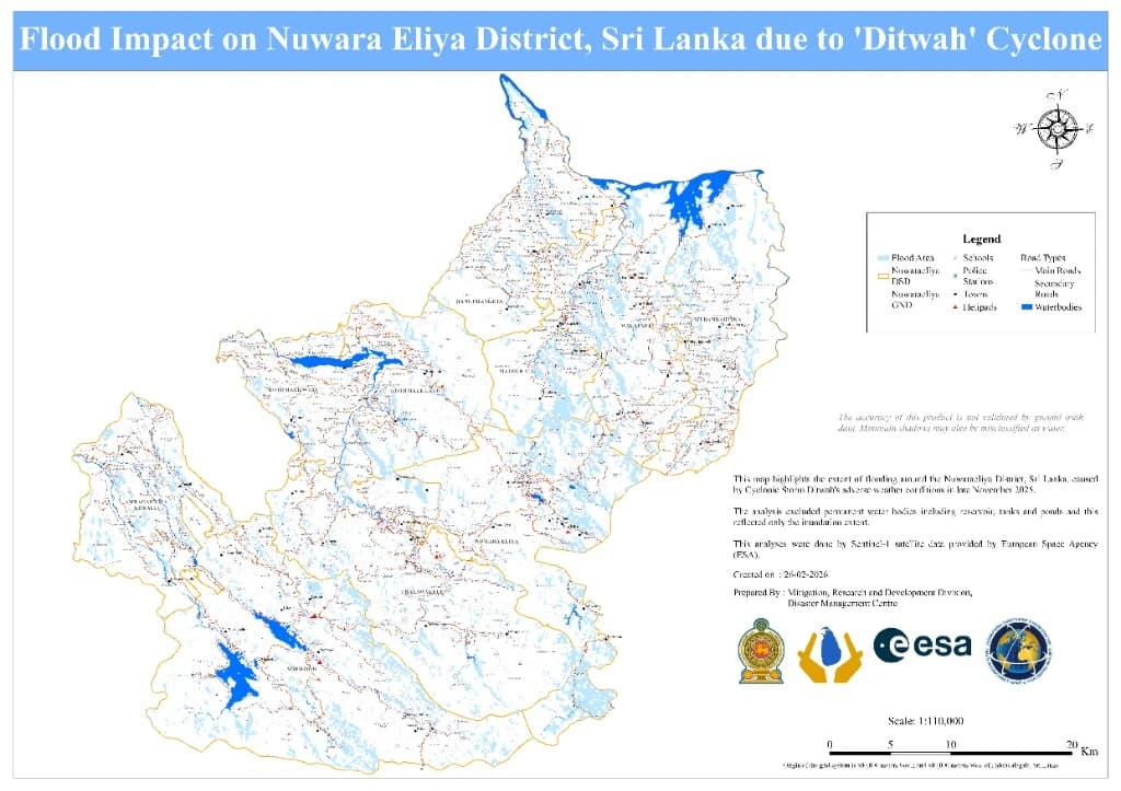
Satellite Inundation Extent
Scale 1:110,00026-02-2026
Disaster Management Centre (DMC) / ESA
Flood Impact on Nuwara Eliya District due to 'Ditwah' Cyclone
Inundation extent derived from European Space Agency (ESA) Sentinel-1 satellite radar data following adverse weather from Cyclonic Storm Ditwah.
Inspect High-Res Map→
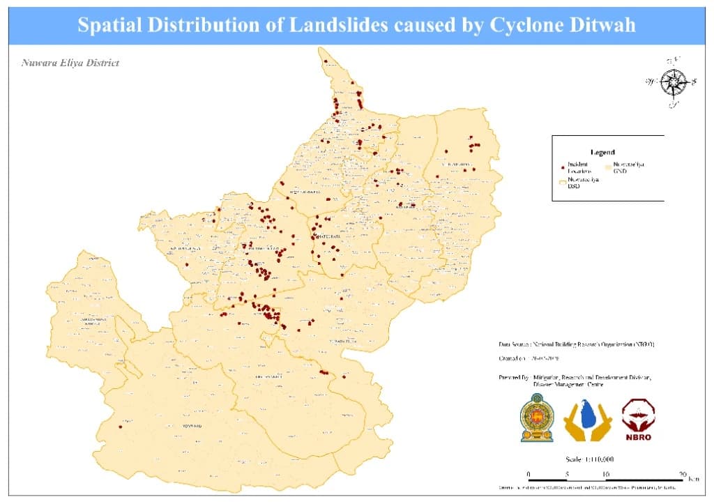
Incident Mapping & Distribution
Scale 1:110,00026-02-2026
National Building Research Organisation (NBRO) / DMC
Spatial Distribution of Landslides caused by Cyclone Ditwah
Verified incident locations of landslides across Nuwara Eliya Divisional Secretariats compiled by the National Building Research Organisation (NBRO).
Inspect High-Res Map→
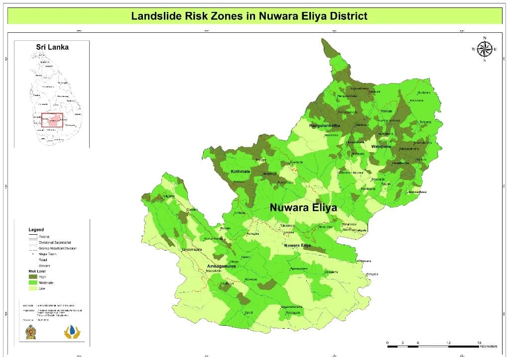
Hazard Susceptibility Zonation
Scale 1:110,0002026
Mitigation, Research & Development Division / DMC / NBRO
Landslide Risk Zones in Nuwara Eliya District
Multi-tier hazard risk classification (High, Moderate, Low) across all Divisional Secretariat and Grama Niladhari divisions.
Inspect High-Res Map→
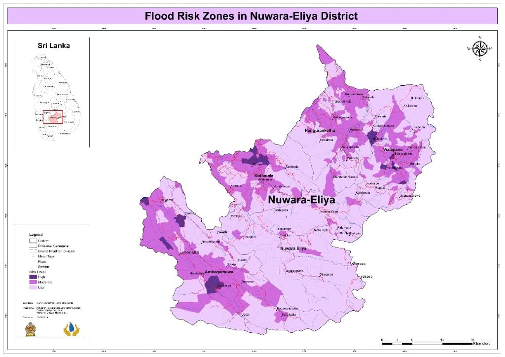
Flood Vulnerability Zonation
Scale 1:110,0002026
Disaster Management Centre (DMC)
Flood Risk Zones in Nuwara Eliya District
Comprehensive flood vulnerability map categorizing High, Moderate, and Low inundation susceptibility zones in highland basins and river valleys.
Inspect High-Res Map→
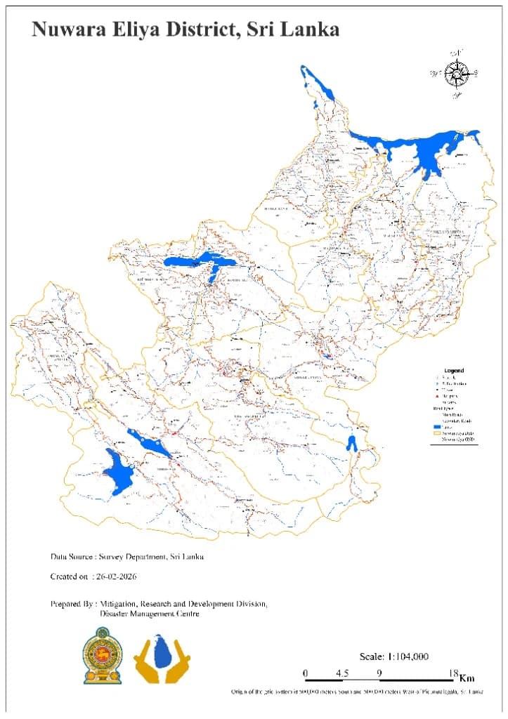
Official Reference Base Map
Scale 1:104,00026-02-2026
Survey Department, Sri Lanka / DMC
Nuwara Eliya District Administrative & Topographic Base Map
Official administrative boundaries, road network, police stations, schools, and helipad emergency infrastructure prepared by the Survey Department.
Inspect High-Res Map→
Hazard Management
Key Hazard Profiles & Preparedness
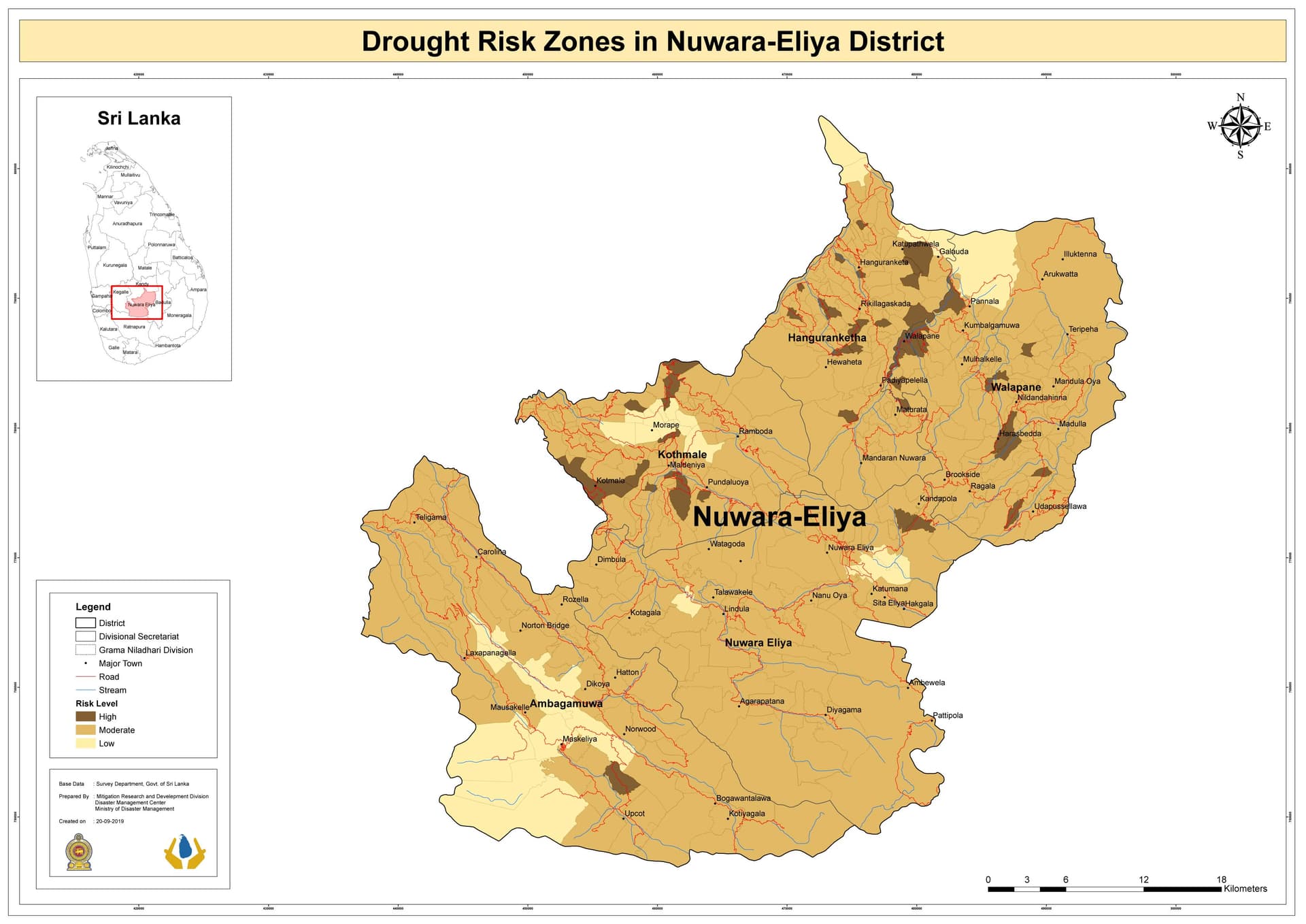
Drought Risk Areas
While the district receives frequent rainfall, certain areas experience water shortages during dry seasons, affecting agriculture and drinking water supply.
Preparedness & Resilience
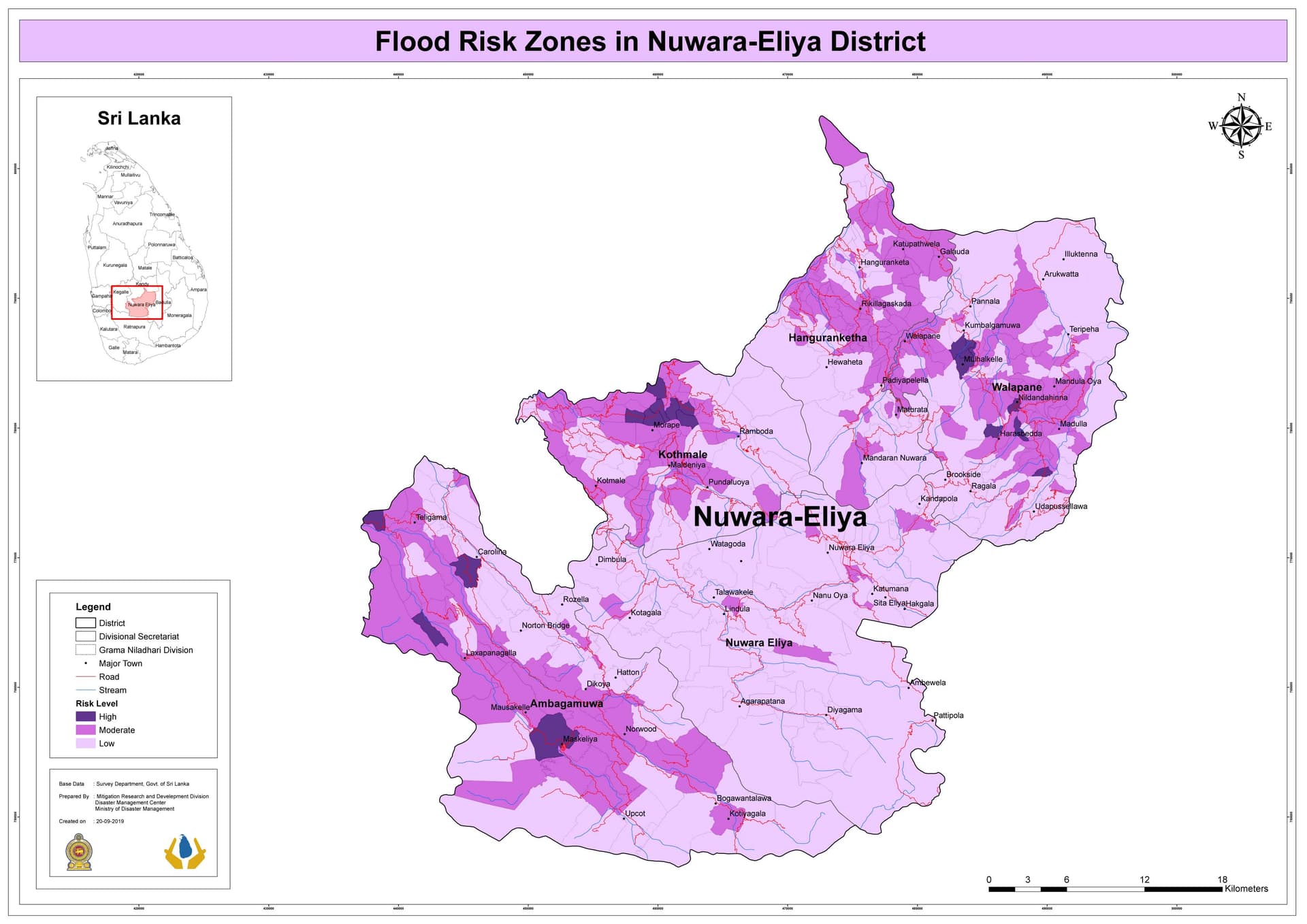
Flood Risk Areas
Intense monsoon rains cause river overflows and flash floods, affecting low-lying areas.
Preparedness & Resilience
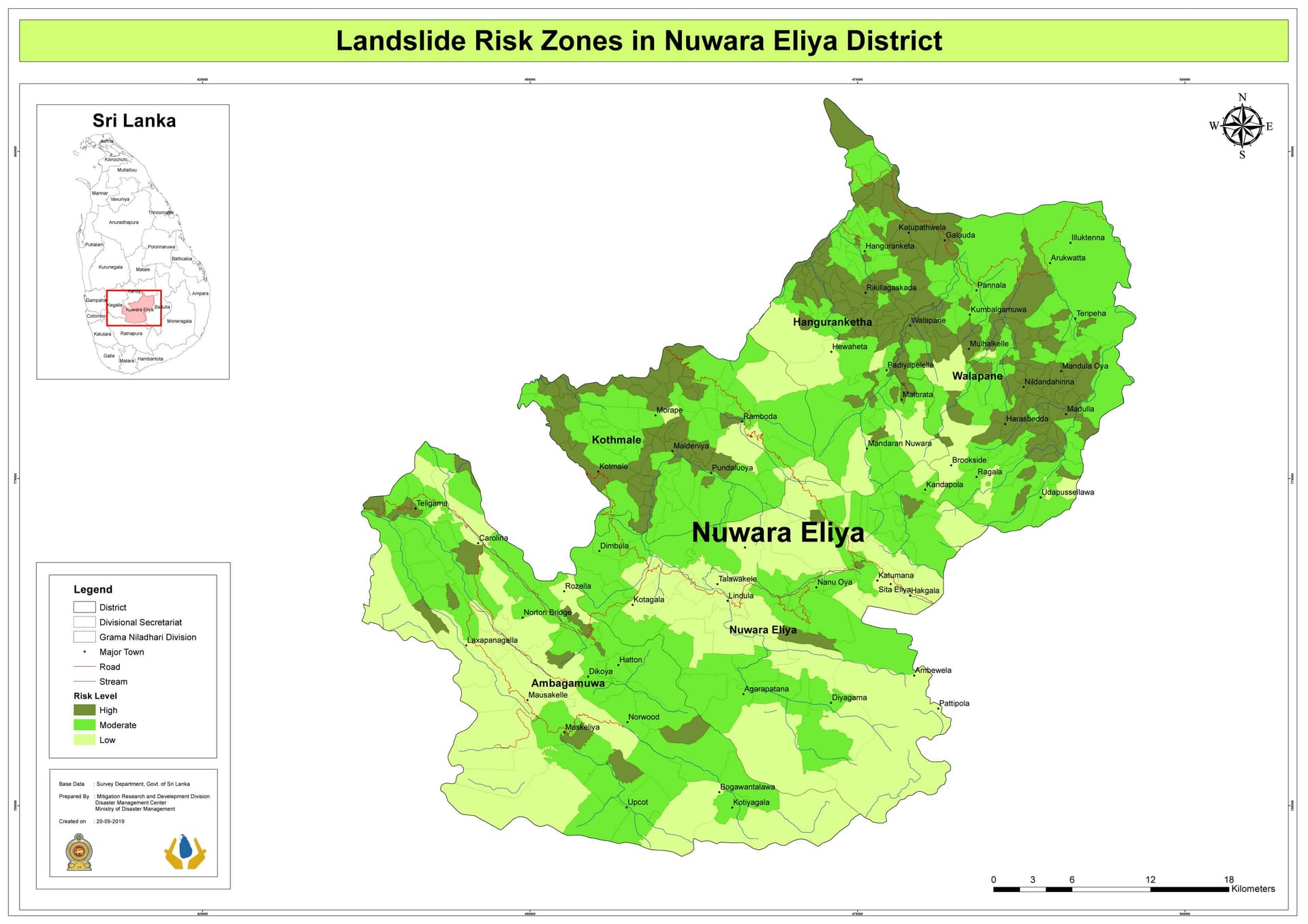
Landslide Risk Areas
Due to heavy rainfall and steep slopes, landslides are a significant threat, especially in areas like Nuwara Eliya town, Hatton, and Maskeliya.
Preparedness & Resilience
Situation reports
Situation
District-level verified incident impact analytics

Search Situation
Select parameters to extract authenticated reports from the District General Database.